Digital archive of Šechtl & Voseček Studios
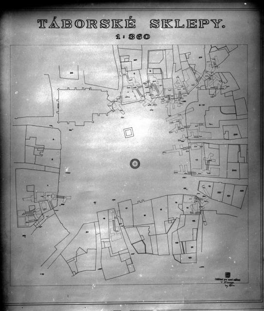
Tábor cellars – map
- ID:
- desky/deska0595
Order print from this photograph - Name:
- Tábor cellars – map
- Description:
- Automatic description:
- A cleaner technical plan records parcel and building outlines around a square together with a network of underground spaces and passages. A prominent title and scale are at the top, with a small official note and signature at the bottom.
- Year:
- Large glass plate negatives has been in use in the years 1880-1950.
Help us exactly date this photograph,please! - Author:
- Šechtl & Voseček archive(no closer identification)
- Keywords:
- Tábor, architecture
- Automatic keywords:
- mapa, plán sklepů, architektonický plán, měřítko, sklepní chodba, square, domy
- Material:
- negative13x18
- Categories:
- Cellars in Tábor
- Texts on the photo:
- TÁBORSKÉ SKLEPY.,1:360,Oddělení pro nové měření v Praze
- Location:
This is automatically generated preview from raw scan. The quality of automatically generated previews might vary. The images are scanned in 16-bit depth and high resolution and it is possible to tune them, retouch the scratches and make details. See the galeries.

Email us, if you have some additional informations about the photograph or if you are interested in the other use of the photograph.
All rights reserved, the copyright owner is © Marie Michaela Šechtlová. Photo archive is maintained by Jan Hubička